Firstly, (another) quick word about the complexities of organisation of cadastral data in the UK. There are separate cadastral agencies for each of England and Wales, Scotland, and Northern Ireland (note the Oxford comma), which run in different ways: not least because the legal framework of Scot's Law is quite different from English Law. Thus the data released only relates to England and Wales.
Comparison of Land Registry parcels with gardens on OSM in Sutton Coldfield
Scatter plot with log-log scale.
Thursday 31 October 2013
Not very INSPIREd: Land Registry 'Open' Data
Many OpenStreetMap contributors have been very excited about the potential for importing address information from data sets released under the European Union's INSPIRE directive. Our experience in the UK tends to make us more cautious in our expectations, and so it proved with the latest release of Open Government Data under this programme.

Wednesday 2 October 2013
OpenStreetMap at a Public Inquiry
Summary (tl;dr)
OpenStreetMap featured in a Public Inquiry about whether a particular route was a Public Right of Way (PRoW). I appeared as a witness at this Inquiry for Paul Sladen (another OSMer) regarding how it has been mapped on OSM. This post describes the unusual circumstances as to why the status of Lenton Road path is controversial, a bit about the history of the path, details of my statement and the hearing, and a little bit about other uses of OSM in official planning processes.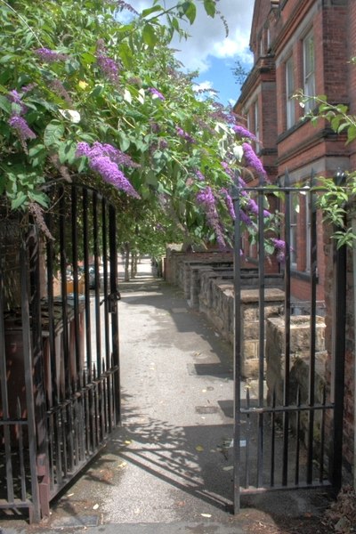 |
| Gate at the Lenton end of Lenton Road. The installation of this gate and later locking of the gate at night time was one of the sources of disagreement about the status of the footpath. Source: Mick Garratt on Geograph via Wikimedia Commons |
Subscribe to:
Posts (Atom)